There are tons of activities to do around the Strom Thurmond Dam – hiking, biking, fishing, boating, swimming, and enjoying picnics and beaches. If you would like ideas for a day trip in that area, you can visit the recreation areas on either side of the dam as well as hike nearby trails such as the Bartram Trail.
Strom Thurmond Dam
Strom Thurmond Lake is a man-made lake on the Savannah River between Georgia and South Carolina. Originally called Clarks Hill Lake, and the state of Georgia still officially recognizes it by that name. The dam provides flood control, hydroelectric power, recreation, and fish and wildlife management.
Highway US-221 crosses the dam to connect South Carolina and Georgia. There are two viewing areas from the South Carolina/east side – the Visitor Center and the Below Dam Recreation Area.
From the visitor center, you can see the upper view with the lake’s higher water line.
As the name suggests, from the Below the Dam Recreation Area you get full views of the dam and the resulting lower water level. If you time it right, you can watch a water release.
Below the Dam is free to the public. In the recreation area, you can observe the dam from a large deck. There are dozens of benches to rest on and take in the view. Several people were fishing from the deck the day I visited.
There is also an inclined walkway that will take you up for an even closer look to the dam.
Facilities around the loop parking area include a covered picnic shelter, restrooms, and a paved walking trail. From this parking area, you can also see the dam face-on.
This area is part of the South Carolina National Heritage Corridor which runs from the Blue Ridge Mountains to the Charleston Lowcountry.
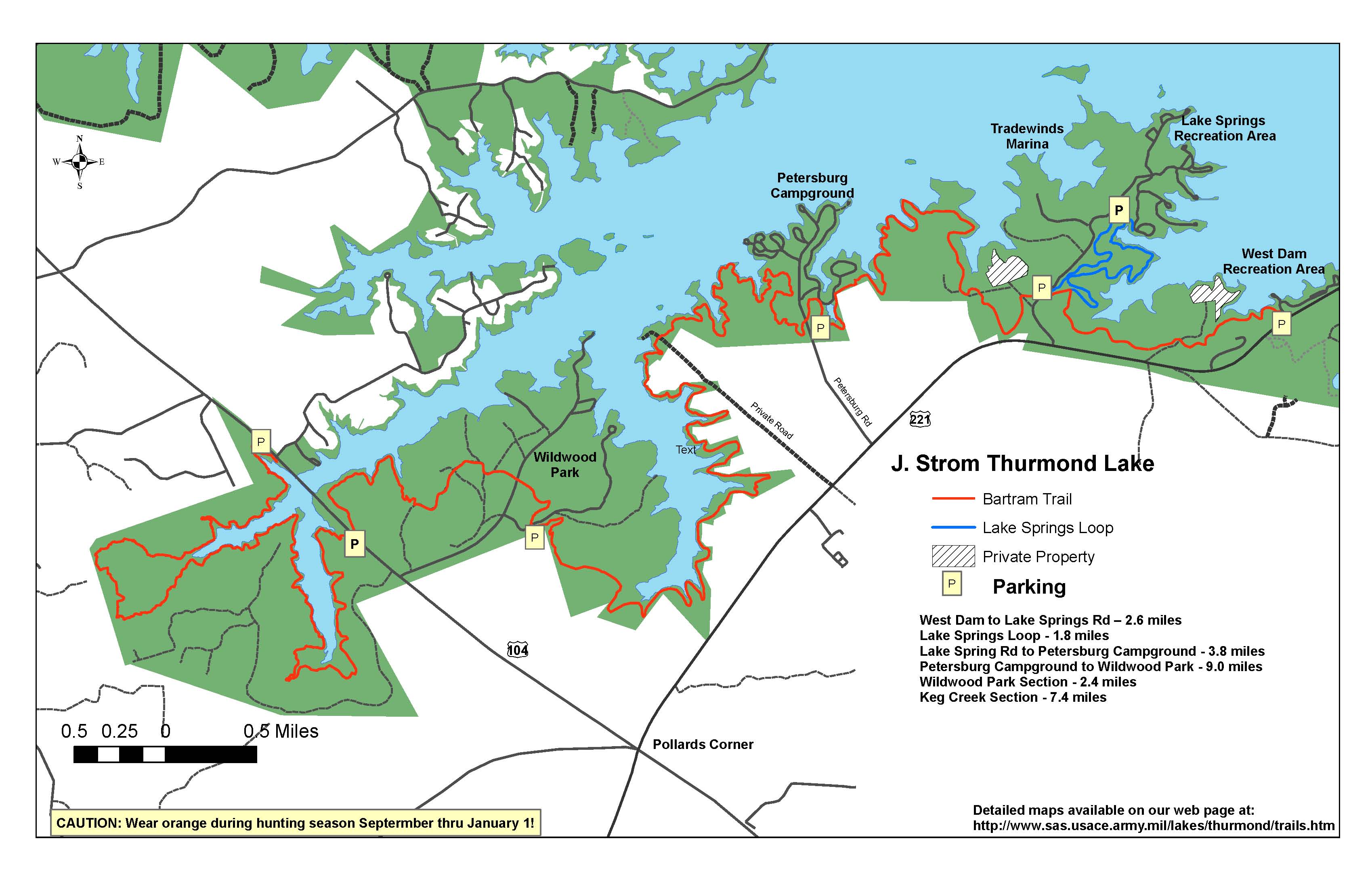
Bartram Trail
The Bartram Trail is a 115-mile trail from northern Georgia into North Carolina. It runs the approximate route of naturalist William Bartram’s journey in the 1770s. Georgia’s portion of the trail is 37 miles. I hiked the southern end near the South Carolina border.
This portion of the trail starts at the West Dam Recreation area trailhead, just inside Georgia’s border. There is a small gravel parking lot after the West Dam entrance, before you reach the fee station for the recreation area. It is free to park, hike, and bike from this trailhead. Three other parking lots are available along the trail.
I would consider this a moderate trail because tree roots and rocks make for rough terrain. The path transitions between dirt, sand, and rock sections.
Bartram Trail has yellow blazes and yellow mile-marker posts every half mile.
Shortly after starting the trail, there is a spur trail down to the water, the Lake Spring Creek section of the lake. Along the rest of the trail there are sporadic views of the lake through the trees.
Wildlife
For birders – American redstarts, cardinals, Carolina wrens, common yellowthroats, eastern towhees, eastern wood-pewees, pine warblers, red-eyed vireos, and tufted titmice could be heard throughout my hike.
I also spotted anole lizards, dragonflies, and butterflies like a red-spotted purple and question mark butterfly. On my way back to the trailhead late in the afternoon, the sky was dark with clouds and developing rain. Hearing movement, I observed a deer running in the woods. Moments later, I saw a coyote next to the trail ahead. It was gone in a second, likely chasing after the deer. This was my first encounter with a coyote in nature.
More Hikes
For visitors looking for an additional hike, Lake Springs Loop is accessible from the Bartram Trail.
The entire Bartram Trail boasts hardwood forests, rhododendron forests, streams, waterfalls, and views from summits like Cheoah Bald, Rabun Bald, and Wayah Bald. There is significant elevation gain and some river crossings which makes hiking the full trail more difficult.


