Construction for the Blue Ridge Parkway started in 1935 and all but 7.5 miles (winding around the rocky perimeter of Grandfather Mountain) were completed by 1967. This last portion became the Linn Cove Viaduct, which opened to the public in 1987. There are four regions: Ridge, Plateau, Highlands, and Pisgah. Virginia covers the Ridge and Plateau Regions.
Visiting the Parkway
The parkway has over 360 miles of hiking trails, 380 overlooks, and several waterfalls. The best way to plan and execute your drive is to know the milepost (MP) markers. The Ridge Region runs from milepost 0 to 106 and the Plateau Region finishes Virginia’s section from milepost 106 to 217.
They often close sections of the road for construction or weather conditions. Your best bet is to check the National Park Service closures page. Due to speed limits, it typically takes about an hour to drive 30 miles.
My Favorite Spots Along Virginia’s Blue Ridge Parkway
Hickory Spring Parking Area (MP 11.7)
This parking area sits next to a historic spring. Across the road is a view of Torrey Ridge.
Three Ridges Mountain Overlook (MP 13.1)
You won’t see three ridges as the mountain was named for the view seen on the opposite side of the ridgeline.
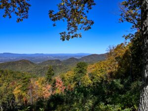
Twenty-Minute Cliff Overlook (MP 19.0)
In June and July, this cliff helps the White Rock Community tell time. Twenty minutes after sunlight hits the rockface, the sun drops behind the mountains and dusk falls on the valley below.
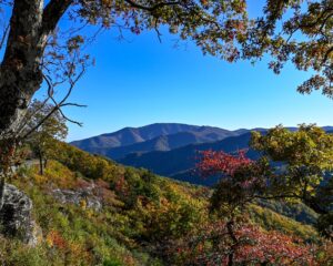
Tree limbs framing my view of the mountains was stunning in autumn.
The Slacks Overlook (MP 19.9)
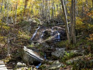
Two main hiking trails have access points from here – The Slacks Trail and White Rock Falls Trail. White Rock Falls sits between the White Rock Gap Parking Area and this overlook.
Crabtree Falls (MP 27.2)
The moderate 2.7-mile hiking trail for Crabtree Falls is a short drive from the Blue Ridge Parkway. Located in the George Washington and Jefferson National Forests, the waterfall is a series of 5 major cascades surging over 1,200 feet!
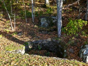
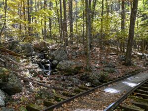
Yankee Horse Ridge Parking Area (MP 34.4)
A section of narrow-gauge railroad has been reconstructed here. The Irish Creek Railroad was originally 50 miles long. Along the tracks, there is a small cascade.
Visitors can walk the tracks and view a waterfall – Wigwam Falls. The trail up to the 30-foot waterfall is almost immediately after the bridge, to the left. It is easy to miss, especially in the fall with leaves covering the path. After the turn, the trail takes a short climb to the base.
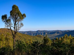
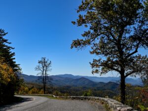
Chimney Rock Mountain Overlook (MP 44.9)
Looking back at the curve of the parkway, I loved the view of the road, trees, and Blue Ridge Mountains in the background.
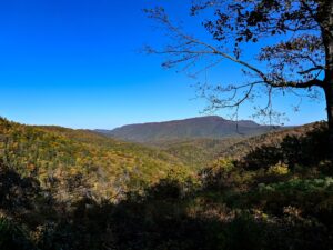
House Mountain Overlook (MP 49.3)
Big House and Little House Mountains stand among the Alleghenies. In the distance, their outlines merge into a single silhouette.
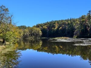
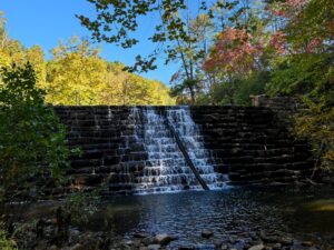
Otter Lake Overlook (MP 63.1)
Otter Lake offers visitors lake views, fishing, a waterfall, and a loop hiking trail. From the parking area (MP 63.2) there is a short trail down to the creek. Here Otter Creek tumbles over the dam, creating a small waterfall.
Arnold Valley Overlook (MP 75.3)
Arnold Valley sits at the foot of the Allegheny Mountains.
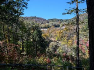
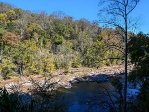
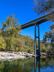
Roanoke River Parking Area (MP 114.9)
In addition to the overlook for Roanoke River Gorge, there is a moderate difficulty trail along the cliffs to two lower viewpoints. Both viewpoints start on the same trail and then split near the underside of the parkway.
Signs direct visitors to a balcony view of the river. This balcony is 1000 feet from the overlook. It has ok views of the river but does not show the main gorge area.
The other path takes you down 190 steps to the river. This view was not worth it in my opinion, especially with all the steps.
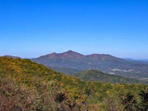
Cahas Mountain Overlook (MP 139.0)
Cahas Mountain is part of the higher elevations in Virginia’s Blue Ridge Mountains, with a summit of 3571 feet. The overlook sits at just over 3000 feet.
Devils Backbone Overlook (MP 143.9)
This overlook offers views of Devil’s Backbone, Pine Spur, Blackwater Valley, and Grassy Hill.
Rough or rocky features often have ‘devil’ in their names. Devil’s Courthouse is along the Blue Ridge Parkway in North Carolina.
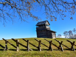
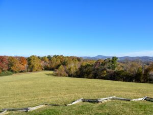
Groundhog Meadow Overlook (MP 189.0)
Picnic tables, an observation tower, and interpretive signs about the rail fences are offered at this overlook. This is a great stop for families near the Virginia/North Carolina border.
I am biased but I prefer the North Carolina section of the Blue Ridge Parkway. The overlooks are generally larger, and the views are stronger in my opinion.
Many more vistas and hiking trails are available to explore along this drive. The Blue Ridge Parkway is perfect for visitors of all ages and skill levels.